Budget
£1 million
Project status
In progress
Duration
Open-ended
£1 million
In progress
Open-ended
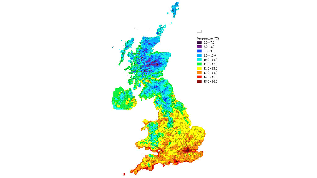
Currently, weather files used for thermal modelling of buildings only represent average weather and not heat waves or cold snaps. Climate change is already having an impact on building design and energy use in the UK. And this will only increase over the coming years.
In 2003, a heat wave in Paris resulted in 14,000 deaths. It is serious incidents like this that highlight the importance of better building design. We need a way to make sure that we design buildings that can deal with extreme weather and the weather in the future.
In addition to this, the current weather files used by the construction industry and building scientists are not as accurate as they should be. They divide the UK into only 14 regions, which is problematic. For example, the whole of the South West peninsular (including up-land areas) is assigned the coastal Plymouth weather file. This can lead to a 200% error in the estimation of annual energy demand. The scale of this error renders many of the dynamic simulations carried out by engineers questionable. This is unfortunate when simulation is used within the framework of the building regulations. But it is fatal when trying to use simulation to estimate how resilient a pre-existing building is or the danger its vulnerable occupants might be in.
This project will investigate whether we can devise a method capable of creating local weather from 2015 to 2080 that covers the whole of the UK at a resolution of 5km. It will also include files that represent various excursions from the mean such as heat waves and cold snaps.